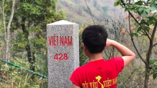
Discover Ong Can Island – a landmark marking Vietnam’s territorial sea
BINH DINH – Hon Ong Can is point A9 – one of 11 points on the straight baseline along the coast of continental Vietnam.
Ngo Tran Hai An (Devil Coc Tu), travel blogger, has conquered journeys along Vietnam or through many countries around the world. Below is Hai An’s share of the journey to conquer milestone A9 on the baseline defining Vietnam’s territorial sea. Before that, he conquered the landmarks of A3, A4 and A5 in Con Dao .
“In addition to the passion of conquering, I really want my story images to contribute to spread to everyone’s pride in the homeland, the country, and pride in Vietnam’s borders and territorial borders. South of us, “shared blogger Hai An.
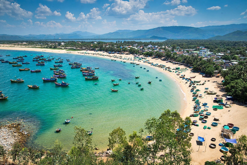
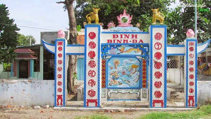
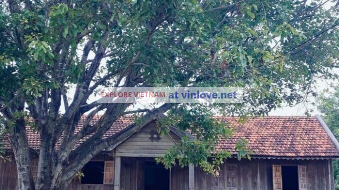
Binh Dinh was known by names such as Ghenh Rang, Ky Co, Eo Gio … but few people hear about Ong Can islet. In addition to its unspoiled beauty, this is also home to landmark A9 – the base point on Vietnam’s territorial sea.
Through the introduction of a close friend, I turned to Tinh, who lives in Nhon Ly and works as a tourist, to express my desire to come to Ong Can island. Knowing my wishes, Mr. Tinh wondered because the weather was erratic this season, the wind was strong, around Ong Can island there were lots of reefs, so it was difficult for boats and boats to land.
Finally, I and my new friends in Binh Dinh also decided to leave. We check the weather and calculate carefully and decide to leave at 1pm. In the group, there are many local people who have never set foot here, everyone is eager.
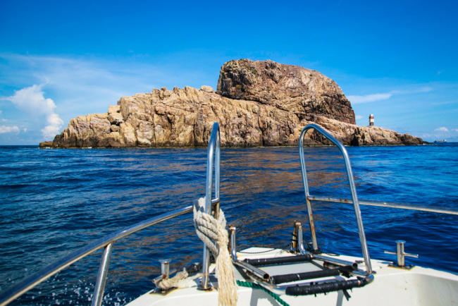
At 13:00, the canoe left the station, the sky was blue, but the wind was strong, the canoe plunged on the sea surface and tore the waves that hit 2 – 3 meters high. From Eo Gio, we began to cross the Hon Co. The farther away from the wind, the stronger a wave pushed the canoes up and fell freely into the sea, everyone was startled and more careful.
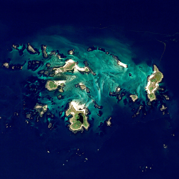
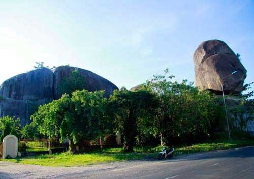
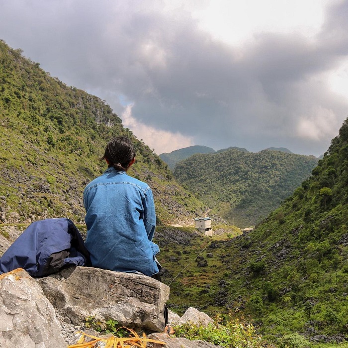
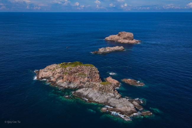
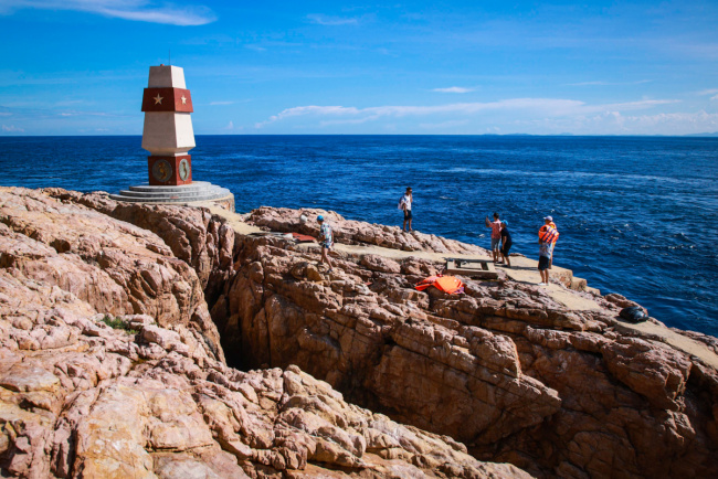
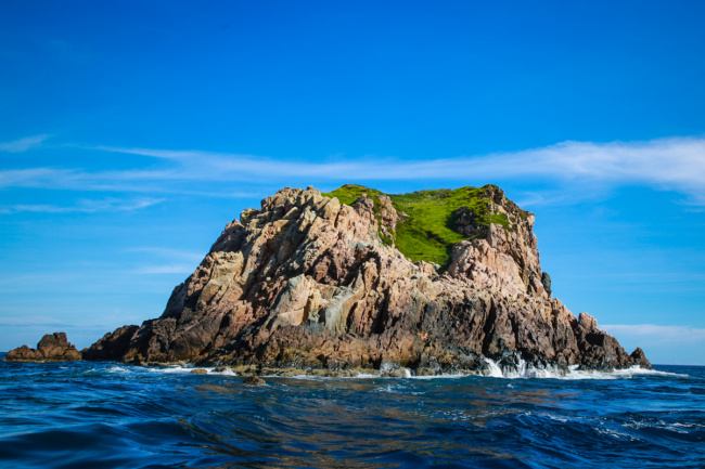
About 15 minutes later, Ong Can island appeared in the front, caught my eye, were three consecutive islands, about 200 meters apart, the landmark was set up on the furthest island.
As canon approached, everyone was stunned. In the middle of the immense sea stands a giant rock of more than 20 meters high, the rock cracked in half to create a deep gap with the waves crashing continuously.
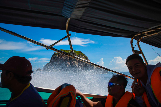
The wind is getting stronger, the canoes are very difficult to access the island, Mr. Tu allows the boat to circle the island many times but still has not found a safe location on the shore. If not, there is only option that we wear life jackets and swim to the island – quite dangerous because the waves can sweep people into the surrounding sharp rocks, the shells of the oysters are very sharp.
With extensive experience, Mr. Tu found a fairly light wave area. But we still had to jump over the rapids, the atmosphere was quite tense right now. When the canoe got close to the rocky shore, Mr. Tu started the engine to shock again to avoid the waves hitting the shore, a man jumped ashore looking for an anchor point. Every wave comes, canoes are pushed ashore, we also jump on each wave that turn on Ong Can island.
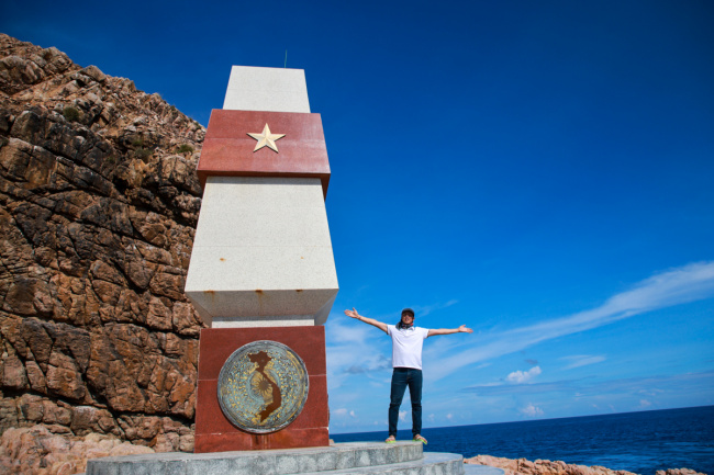
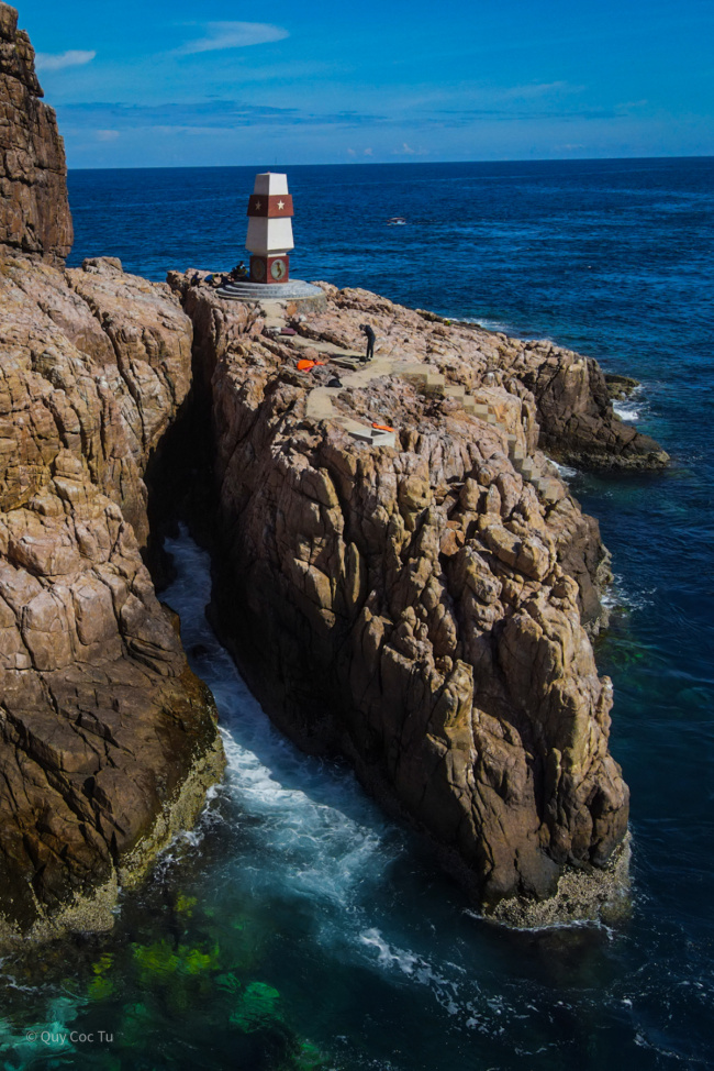
Going through 20 steps, I reached milestone A9. According to archival documents, Ong Can Islet was formed due to volcanic eruption millions of years ago, lava flow encountered seawater, so it suddenly froze.
The island is located at 13 ° 53’57 ″ North 109 ° 21’08 ″ East, about 7 km from the shore in the east, about 140 km from point A8 to the south, about 170 km from point A10 to the north. The island belongs to Nghiem Kinh Chieu island cluster, Nhon Ly island commune, with a length of about 200 m, the widest part about 95 m.
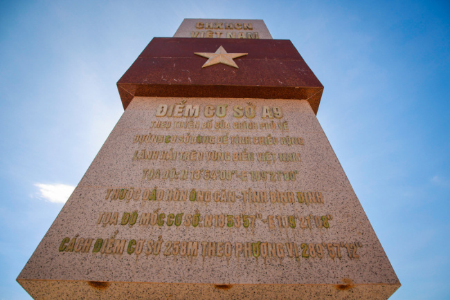
On the island set landmark A9. Not far from the landmark is the national coordinate point built by the Ministry of Natural Resources and Environment, the Department of Geodesy & Mapping in June 2017, bearing the number DH09. Hon Ong Can plays an important role in determining the width of Vietnam’s territorial sea under the 1982 United Nations Convention on the Law of the Sea (UNCLOS).
After 30 minutes of commemorative photography, we quickly returned to the canoe because the wind was stronger, the higher the wave, the harder it would be for us to leave.
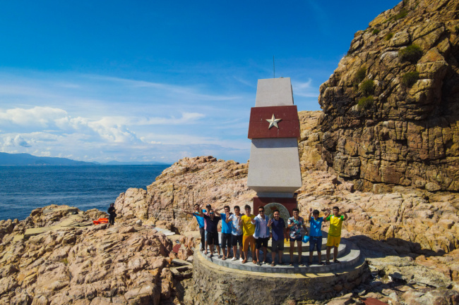
I am proud to conquer the 10th point of 11 on the baseline for positioning the territorial sea of Vietnam, and hope to conquer the last place, point A11 on Con Co island.
Cano ran around all three islands and once again I had the opportunity to see the entire area, on the largest island is a lush green basin. Time was running out, we rushed back to shore, avoiding the coming storms.
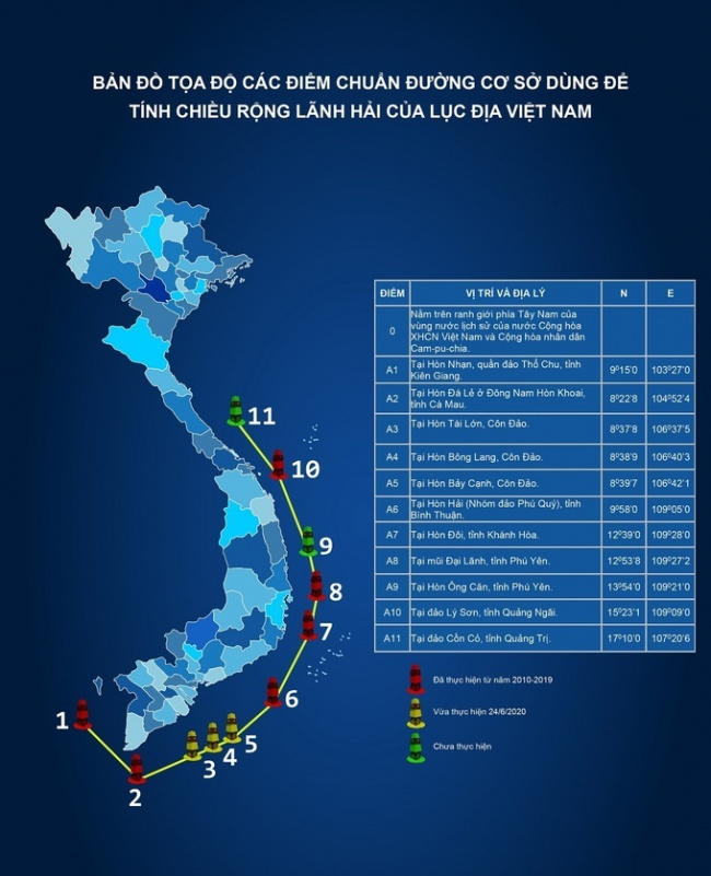
The baseline reference point is used to calculate the territorial sea width of the Vietnamese continent. Graphics: Ngo Tran Hai An
vnexpress
Đăng bởi: Mạnh Tiến